Catálogo - Planisferios y Star Finder
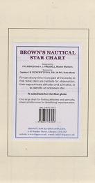
Brown´s Nautical Star Chart
Autor: P. Clissold, A. J. Tweddell
Editorial: Brown, Son and Ferguson
Año de edición: 1.934
9780851747057
Encuadernación: plano desplegable
Plegado: 15,50 x 29,50 cm. Desplegado: 91,50 x 58,50 cm.
14,00€
Contenido:
A Practical Star Chart, 914 X 584 mm, for the Practical Seaman, constructed on Mercator's principle, showing all the stars used in navigation. The brightest stars are conspicuously marked with yellow.
The chart can be used at any time in any part of the world to find what stars will be visible, or to identify an unknown star, and forms an excellent substitute for the well-known Star Globe.
To the navigator, accustomed to terrestrial charts, the use of the Star Chart is simplicity itself. Plot your position, i.e. the position of your zenith on the chart, using the D. R. latitude, and instead of the longitude, the Local Sidereal Time. What stars are visible and their approximate bearings are seen at a glance, and their approximate altitudes can be measured with dividers on the scale on the chart.
There are seven small charts to help in identifying important stars and a guide to the pronunciation of star names.
Precio: 14,00 €, I.V.A. incluido (4%)
[ Volver ]


